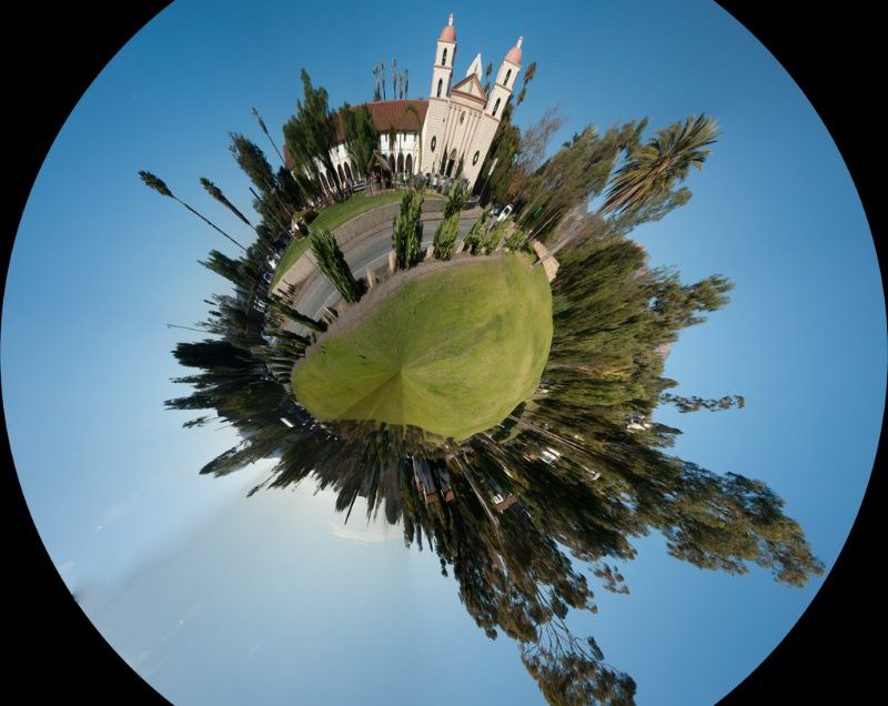
Santa Barbara Mission and West Beach mapped onto Polar Coordinates
Vacations and interesting work trips
Santa Barbara Mission and West Beach mapped onto Polar Coordinates
2011 Steamboat Springs Vacation, with sledding pictures, and pictures of the Catamount Barn, Horses, a Ski-Boot Graveyard, and more.
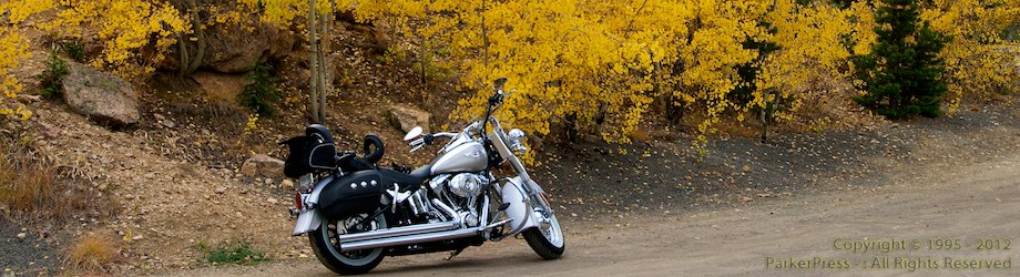
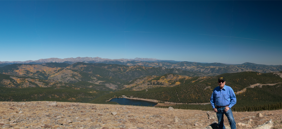
A quick trip up Mount Evans road on the Softail to look at fall colors.
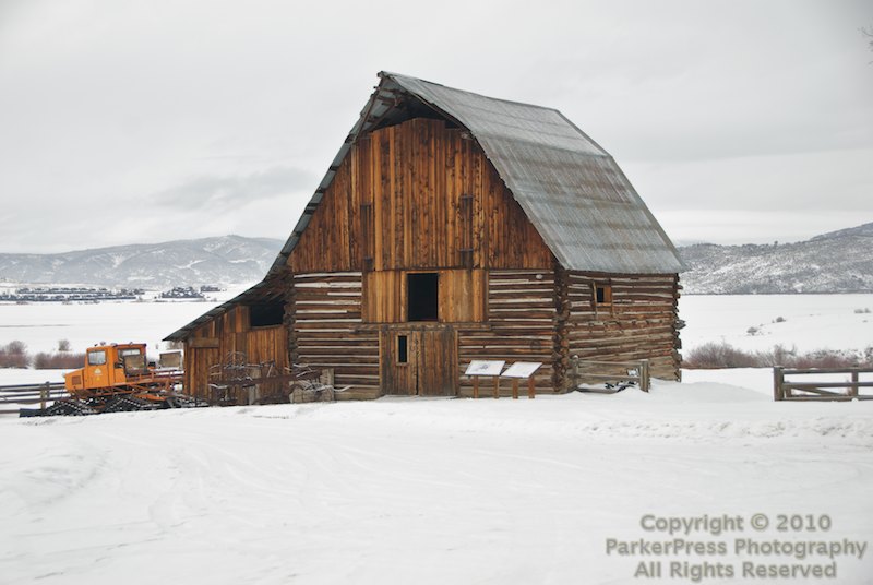
On day 1 of our annual trip to Steamboat Springs this year, we were walking around the Gondola Area to see all the new places that were built in the last year (and there were a LOT). As we walked by the new Ski Patrol office at the base of the Gondola, a picture on the wall caught my eye. A beautiful barn with fall colors behind it that looked almost exactly like the famous Steamboat Barn, but wasn’t. It was a mirror image of it with a beautiful fall-color terrain behind it that doesn’t exist near the barn I take so many pictures of (search for Steamboat Barn).
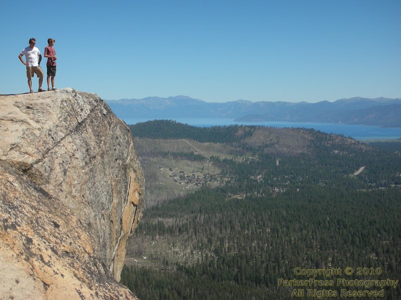
This year’s Tahoe trip was a little more chaotic than usual, but as always, far too short.
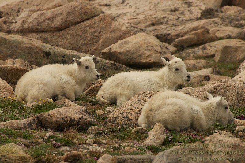
As part of our trip to the 30th Annual Steamboat Balloon Festival last weekend, Gregg Lowrimore and I stopped by Mt. Evans on the way home, hoping for some pictures of this years “baby” mountain goats. We weren’t disappointed… 🙂
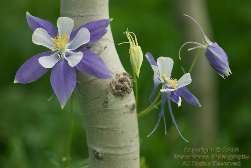
Last weekend, Gregg Lowrimore and I went up to Steamboat Springs to take pictures at the 30th Annual Steamboat Balloon Rodeo (see this link for that story). But… the balloon festival ends really early (like 9am) so we decided to go try to find fields of Colorado’s state flower, the Columbine.
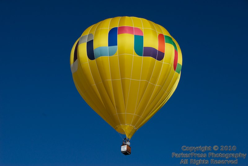
The first day (Saturday) had an unusual northward wind and all the balloons eventually ended up in or near town. The second day went much better with very light winds creating a box that the pilots could use to return to the landing zone (a few made it back).
They got points for going over the lake and touching the water with the basket (called dip-n-dash), but a few got a little carried away, and ended up in more of a “dunk-n-dash”.